| Event: | Severe Thunderstorm Watch | ||
| Alert: |
SEVERE THUNDERSTORM WATCH 258 IS IN EFFECT UNTIL 100 AM EDT FOR THE FOLLOWING LOCATIONS DE . DELAWARE COUNTIES INCLUDED ARE KENT NEW CASTLE SUSSEX |
||
| Instructions: | |||
| Target Area: |
|
||
Hazardous Weather Outlook National Weather Service Mount Holly NJ
758 PM EDT Sun May 26 2019
New Castle-Kent-Inland Sussex-Cecil-Kent MD-Queen Annes-Talbot-Caroline-758 PM EDT Sun May 26 2019
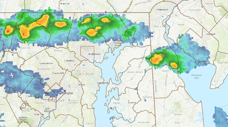
This Hazardous Weather Outlook is for central Delaware, northern Delaware, southern Delaware, and northeast Maryland.
Some thunderstorms could be severe with locally damaging winds and large hail.
The probability for widespread hazardous weather is low.
Scattered showers and isolated thunderstorms will continue to develop in northeastern Maryland and Delaware this evening. Brief downpours are possible along with dangerous cloud to ground lightning. Wind gusts around 40 MPH may occur. If you observe threatening weather, seek shelter at once.