…FLASH FLOOD WATCH REMAINS IN EFFECT FROM NOON EDT TODAY THROUGH LATE TONIGHT…
The Flash Flood Watch continues for
* Northeast Maryland, Delaware, eastern and southeastern
Pennsylvania, and central and southern New Jersey.
* From noon EDT today through late tonight
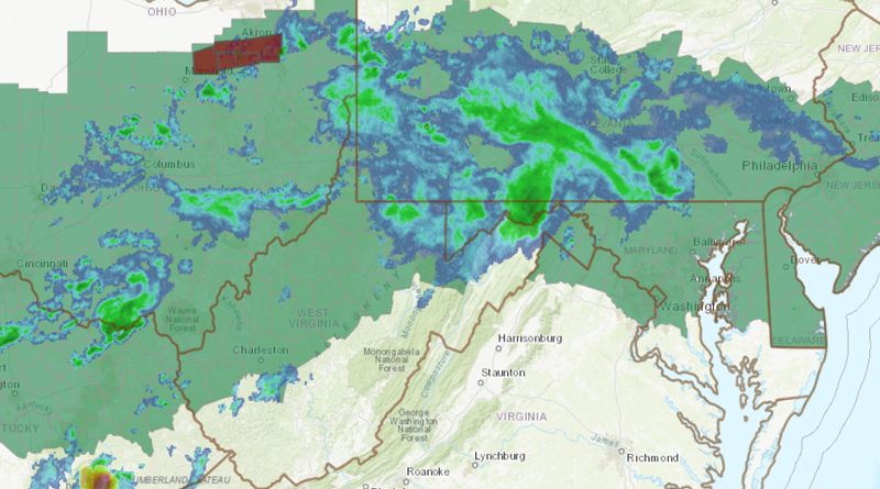
* Strong thunderstorms are expected to develop and move through the region this afternoon and evening. The environment will be favorable for torrential rainfall with these storms.
Additionally, storms may begin to track over the same locations as a very slow-moving front allows for the redevelopment of storms in similar locations over time. There is potential for one to three inches of rain in a very short period of time where the strongest storms occur.
There is a chance of severe storms this afternoon and evening, with the main risk being damaging wind gusts 50-60 mph and torrential rain.
* Flash flooding is possible where the strongest storms develop and persist. Flooding in urban and poor-drainage areas is likely if torrential downpours occur. Rises on small creeks and streams are possible as well.
Recommended Actions
A Flash Flood Watch means that there is the potential for flash flooding, which can be life-threatening. Heavy rain is expected to occur over a short period of time. Rapidly rising flood waters may quickly inundate roadways and areas of poor drainage. Streams and creeks could leave their banks, flooding nearby properties.
Please monitor the forecast, especially if you live in a location that is prone to flooding. Be prepared to take action if a flash flood warning is issued for your area.
Source: National Weather Service