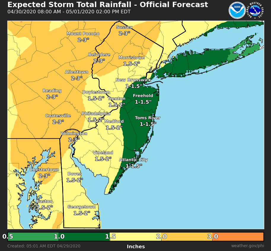
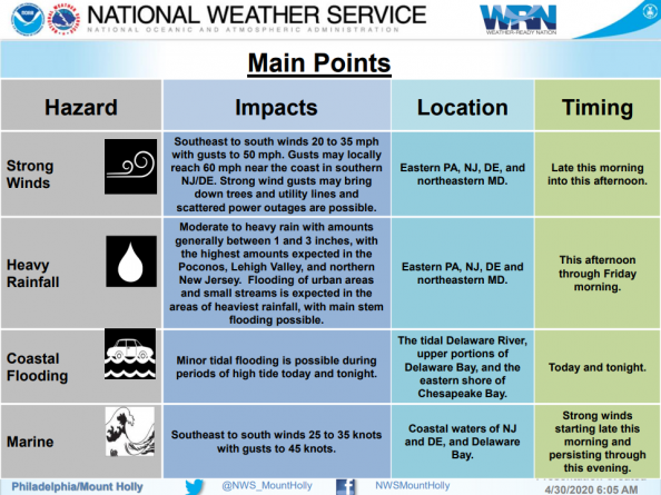
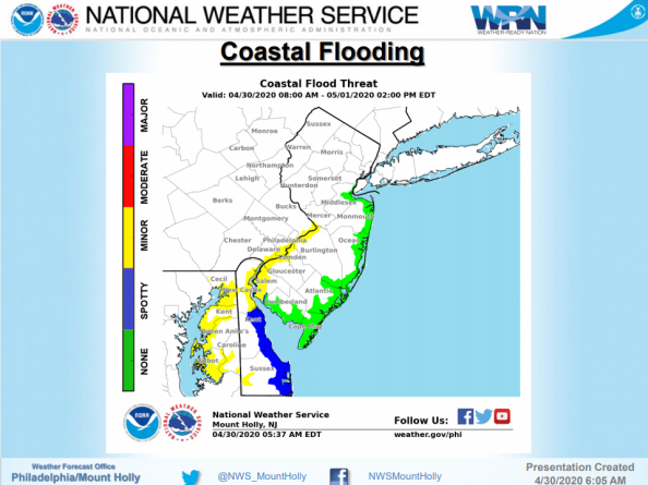
A vigorous storm system will move through the region on Thursday and Friday. The main threats with the system include strong wind gusts on Thursday, heavy rainfall and possible flooding Thursday afternoon through Friday morning and coastal flooding on the tidal Delaware River, the upper portions of Delaware Bay, and the eastern shore of Chesapeake Bay during periods of high tide on Thursd
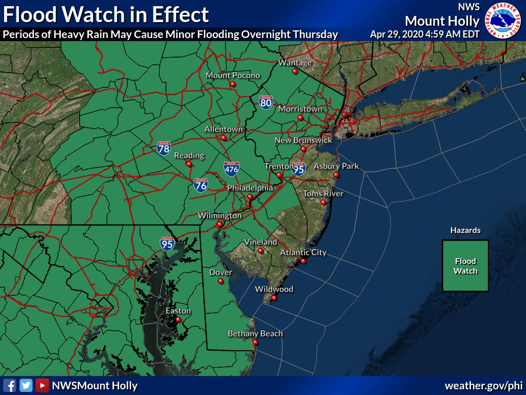
Flood Watch in Effect! Periods of heavy rain will begin Thursday afternoon with the threat of heavy rainfall moving eastward through the overnight hours. Rainfall will decrease in intensity Friday morning but impacts from the earlier heavier rainfall may linger into the day on Friday.
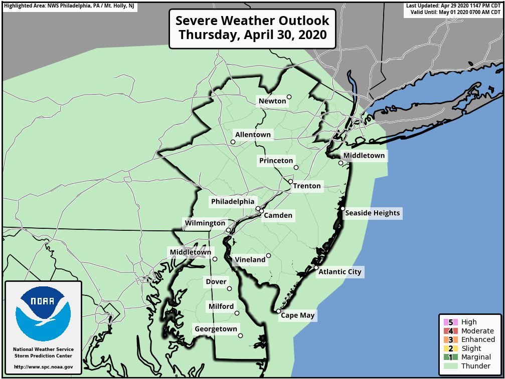
With the cold frontal passage, there could be isolated thunderstorms. Any of the stronger thunderstorms could transport higher winds from aloft to the surface, potentially becoming severe and causing wind damage.