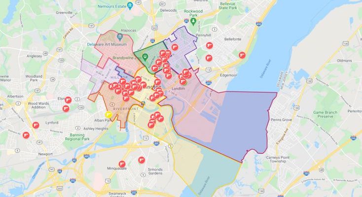
We’re grabbing data from all kinds of sources and adding it to the map below. The map currently shows:
2021 Shootings*
2021 Fatal Vehicle Accidents
2020 School Report Cards
Delaware State House Districts
Delaware State Senate Districts
Municipalities
School District Boundaries
City Council Districts
And we’re adding additional crime stats.
*Shooting data is from publicly available sources and our archives. Some shootings are reported incorrectly on police crime mapping tools so we expect to add additional past 2021 shootings to the map. If you don’t see a shooting incident on the map please message us via Facebook and we’ll look into it.

