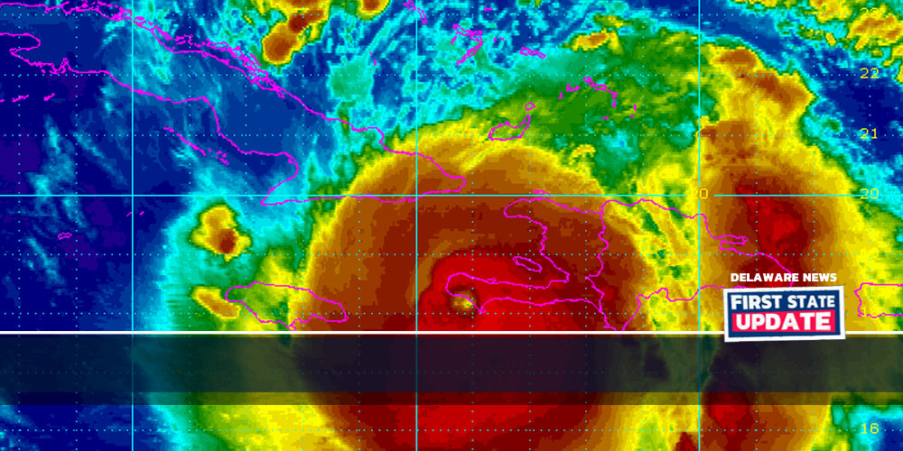
Delaware – (10/4/2016) Hurricane Matthew made landfall in Haiti today with sustained winds of 145 mph and gusts up to 175 mph within the eye-wall.
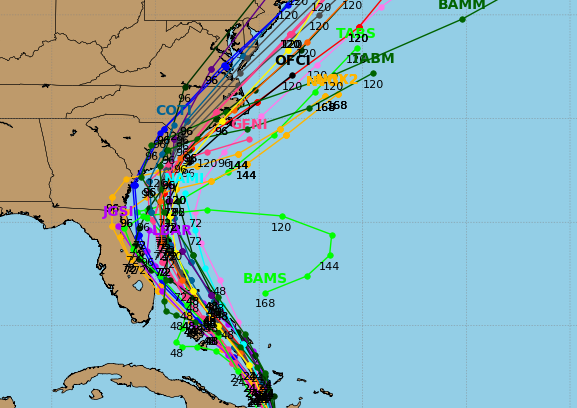
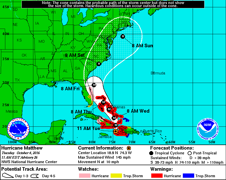
Matthew is expected to travel north through the Caribbean over the next couple of days. A ridge of high pressure will push Matthew towards Florida and South Carolina. Although the latest models show the center of the storm staying just off the coast, some models show it making landfall in Florida, Georgia, South Carolina and North Carolina.
Officials at the Delaware Emergency Management Agency (DEMA) are closely monitoring Matthew’s path and will update the public as more information becomes available.

The Caribbean
Hurricane Matthew has made landfall in Haiti as it continues on its slow track through the Caribbean. Cuba, Jamaica and The Bahamas are in Matthews path. The strongest storm since Hurricane Felix in 2007, Matthew, experts warn could be devastating. Reports from Haiti show massive flooding in the western part of the country. Officials warn that massive mudslide are likely due to deforestation.
Southern US
States all along the East Coast are watching Hurricane Matthew closely. Matthew may hit Florida in just a couple of days, depending on the track. Florida’s Governor Rick Scott has declared a state of emergency for every county in the state.
Georgia’s Office of Emergency Management issued a statement “GEMHSA, in close coordination with local, state, and federal partners and forecasters with the National Hurricane Center and National Weather Service, is preparing for potential impacts from Hurricane Matthew. This is a powerful Category 4 major hurricane. No watches or warnings are currently issued for Georgia as of 8 a.m. Tuesday, October 4.”
South Carolina’s Office of Emergency Management said that “Now is the time to prepare for Hurricane Matthew, here are a few things to keep in mind: https://t.co/rjoJzb4Rfd
North Carolina’s Governor declared a state of emergency for central and eastern North Carolina.

Image Credits: NOAA

