Another round of severe weather will impact the area later today and tonight. Heavy rain will result in flash flooding, and severe thunderstorms will be capable of damaging winds and large hail.
FLASH FLOOD WATCH IN EFFECT FROM 4 PM EDT THIS AFTERNOON THROUGH
LATE TONIGHT
From 4 PM EDT this afternoon through late tonight
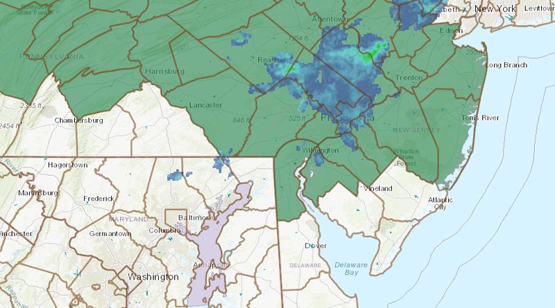
Showers and thunderstorms will move into eastern Pennsylvania and much of New Jersey later this afternoon and this evening.
Thunderstorms will be capable of heavy rainfall, and training of thunderstorms is also possible. Total rain amounts will range from 1 to 2 inches with locally higher amounts possible.
* Flash flooding is possible in places where the heaviest thunderstorms persist. Rises on rivers and streams with urban, small stream, and poor drainage flooding is also possible.
This Hazardous Weather Outlook is for northern Delaware, central New Jersey, northern New Jersey, northwest New Jersey, southern New Jersey, east-central Pennsylvania, northeast Pennsylvania, and southeast Pennsylvania.
Pennsylvania: Berks, Bucks, Chester, Delaware, Lancaster, Lehigh, Montgomery, Northampton, Philadelphia
Delaware: Kent, New Castle
New Jersey: Atlantic, Burlington, Camden, Cape May, Cumberland, Gloucester, Hunterdon, Mercer, Monmouth, Ocean, Salem